搜索结果: 1-15 共查到“知识库 ENVIRONMENT”相关记录965条 . 查询时间(0.156 秒)
Establishment of Regional Phytoremediation Buffer Systems for Ecological Restoration in the Great Lakes Basin, USA. I. Genotype × Environment Interactions
ecosystem services multi-environmental trials (MET) phenotypic plasticity phyto buffers phyto-recurrent selection phytotechnologies poplars Populus
2024/1/10
Poplar remediation systems are ideal for reducing runoff, cleaning groundwater, and delivering ecosystem services to the North American Great Lakes and globally. We used phyto-recurrent selection (PRS...
2020年12月,公共卫生学院流行病学教研室王素萍教授和张亚玮教授团队在top1区期刊《Environment International》(影响因子:7.577)发表了题为“Exposure to multiple metals and prevalence for preeclampsia in Taiyuan, China”的研究论文。该研究首次揭示重金属联合暴露对子痫前期的影响,提示重金属...

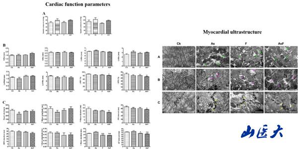
山西医科大学公共卫生学院阎小艳教授团队在《Science of the Total Environment》等期刊发文:阐明砷氟暴露下CVEs毒性机制(图)
山西医科大学 公共卫生学 肠道菌群
2023/12/25
近日,山西医科大学公共卫生学院卫生毒理学教研室阎小艳教授团队在环境毒理学Top期刊《Science of the Total Environment》(中科院期刊分区2区,影响因子:6.551)上发表了题为“Co-exposure to inorganic arsenic and fluoride prominently disrupts gut microbiota equilibrium an...
Detective Mining: Selfish Mining Becomes Unrealistic under Mining Pool Environment
blockchain Bitcoin, security
2019/5/21
One of Bitcoin’s core security guarantees is that, for an attacker to be able to successfully interfere with the Bitcoin network and reverse transactions, they need to control 51% of total hash power....
THE INTEGRATED 3D SURVEY FOR UNDERGROUND ARCHAEOLOGICAL ENVIRONMENT
3D survey Archaeology Laser scanning Close-range photogrammetry
2019/3/1
The task of documentation and conservation of Cultural Heritage defines the challenges that geomatics techniques have to overtake in order to provide different solutions that combine the automation of...
LANDSLIDE HAZARD ZONATION MAPPING OF CHAMOLI LANDSLIDES IN REMOTE SENSING AND GIS ENVIRONMENT
Landslides Chamoli Remote Sensing Hazard, Himalaya
2019/2/27
Landslides are very common problem in hilly terrain. Chamoli region of Himalaya is highest sensitive zone of the landslide hazards. The purpose of Chamoli landslide study, to observe the important ter...
Breaking a Lightweight M2M Authentication Protocol for Communications in IIoT Environment
M2M communications IIoT Authentication
2018/11/9
The concept of the Industrial Internet of Things (IIoT) can be defined as the integration of smart sensor networks and the Internet of Things (IoT). This technology can be employed in various industri...
MULTI-AGENT LEARNING FRAMEWORK FOR ENVIRONMENT REDUNDANCY IDENTIFICATION FOR MOBILE SENSORS IN AN IOT CONTEXT
Mutual information Gaussian Process Regression (GPR) multi-agent system mobile sensor networks IoT sensor planning
2018/11/9
From an IoT point of view, the continuous growth of cheap and versatile sensor technologies has generated a massive data flow in communication networks, which most of the time carries unnecessary or r...
LINKDALE: A LIGHTWEIGHT LEARNING ENVIRONMENT FOR (GEOSPATIAL) LINKED DATA
Linked Data education earning environment reactjs visual linking
2018/11/8
Modern software tools for managing Linked Data are often designed for skilled users. Therefore, they cannot be used for education purposes because they require substantial a priori knowledge about the...
IMPLEMENTATION OF A COMPREHENSIVE AND EFFECTIVE GEOPROCESSING WORKFLOW ENVIRONMENT
Workflow Geoprocessing Remote Sensing Earth Observation
2018/11/8
Many projects and research efforts implement geo-information (GI) workflows, ranging from very basic ones to complicated software processing chains. The creation of these workflows normally needs cons...
ORTHORECTIFICATION OF A LARGE DATASET OF HISTORICAL AERIAL IMAGES: PROCEDURE AND PRECISION ASSESSMENT IN AN OPEN SOURCE ENVIRONMENT
image orthorectification GIS historical aerial images
2018/11/8
The availability of data time series spanning a long period is crucial for landscape change analysis. A suitable dataset, both in terms of time span and information content, must be available for the ...
THE RESEARCH AND EVALUATION OF ROAD ENVIRONMENT IN THE BLOCK OF CITY BASED ON 3-D STREETSCAPE DATA
3D streetscape data block unit urban assessment model street environment traffic environment urban plan
2018/5/14
This paper focus on the problem of the street environment of block unit, based on making clear the acquisition mode and characteristics of 3D streetscape data,the paper designs the assessment model of...
THE SPATIAL-TEMPORAL ANALYSIS OF ECOLOGICAL ENVIRONMENT OF RED BED HILLS IN EAST SICHUAN - TAKING LU COUNTY AS A CASE
Ecologic environment Hilly area AHP (Analytic Hierarchy Process) RS GIS
2018/5/15
Good ecological environment is the foundation of human existence and development, the development of society and economy must be based on the premise of maintaining the stability and balance of the ec...
ECO-ENVIRONMENT STATUS EVALUATION AND CHANGE ANALYSIS OF QINGHAI BASED ON NATIONAL GEOGRAPHIC CONDITIONS CENSUS DATA
national geographic conditions census remote sensing eco-environment status ecological index ecological change analysis
2018/5/17
As the headstream of the Yellow River, the Yangtze River and the Lantsang River, located in the hinterland of Qinghai-Tibet Plateau, Qinghai province is hugely significant for ecosystem as well as for...
EVALUATION OF ECOLOGICAL ENVIRONMENT SECURITY IN CONTIGUOUS POVERTY ALLEVIATION AREA OF SICHUAN PROVINCE
Ecological Environment Safety Contiguous Poverty Alleviation Area Ecological Environment Safety Assessment Analytic Hierarchy Process
2018/5/16
According to the overall requirements of ecological construction and environmental protection, rely on the national key ecological engineering, strengthen ecological environmental restoration and prot...

