搜索结果: 1-15 共查到“工学 River”相关记录208条 . 查询时间(0.296 秒)

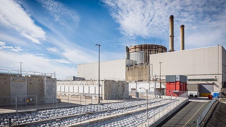
Canada authorizes building of LLW disposal facility at Chalk River(图)
加拿大核实验室 低放射性废物 近地表处置设施
2024/2/1

New method ensures integrity of Savannah River’s radioactive material containers(图)
萨凡纳河 放射性物质 容器完整性
2024/3/7


New reactor dismantling technique used at Crystal River(图)
Crystal River reactor dismantling technique
2023/3/7
3D DETECTION AND RECONSTRUCTION EXPERIMENTS IN RIVER BASINS
Photogrammetry Google Earth 3d Reconfiguration Digital terrain Model Drone
2019/3/4
The survey and representation of river landscapes require complex operations related to the habitat identifying these environments that show heterogeneous connotations in which the anthropogenic conta...
FLOOD RISK ASSESSMENT OF RIVER KABUL AND SWAT CATCHMENT AREA: DISTRICT CHARSADDA, PAKISTAN
Hazard, Vulnerability, Risk, Geographical information system (GIS), Remote sensing (RS), Disaster risk reduction (DRR), Participatory rural appraisal (PRA) tools, Weighted overlay
2018/11/8
Pakistan is prone to natural hazards including floods, in particular, affecting millions of people each year across the country. Patterns from recent years suggest the intensity of flooding are increa...
ANALYSIS OF THE TONLE SAP FLOOD PULSE BASED ON REMOTE SENSING: HOW MUCH DOES TONLE SAP LAKE AFFECT THE MEKONG RIVER FLOOD?
Remote Sensing Tonle Sap Lake Flood Mekong River Water Storage
2018/5/15
The economic value of the Tonle Sap Lake Floodplain to Cambodia is among the highest provided to a nation by a single ecosystem around the world. The flow of Mekong River is the primary factor affecti...
STUDY ON REMOTE SENSING IMAGE CHARACTERISTICS OF ECOLOGICAL LAND: CASE STUDY OF ORIGINAL ECOLOGICAL LAND IN THE YELLOW RIVER DELTA
Ecological Land Remote Sensing Spectral Characteristics Yellow River Delta NDVI
2018/5/11
Takes the Yellow River Delta as an example, this paper studies the characteristics of remote sensing imagery with dominant ecological functional land use types, compares the advantages and disadvantag...
ESTIMATION CODMN IN GUANGZHOU SECTION OF PEARL RIVER BASED ON GF-1 IMAGES
COD_Mn GF-1 water color remote sensing Pearl River Guangzhou
2018/5/14
Due to the way that remote sensing works, it has natural advantage to detect optical constituents in waters. And many kinds of inversion models were constructed based on the three main optical constit...
DEM BASED REGISTRATION OF MULTI-SENSOR AIRBORNE POINT CLOUDS EXEMPLARY SHOWN ON A RIVER SIDE IN NON URBAN AREA
airborne point clouds registration 2.5D DEM multi sensor
2018/6/4
This paper presents a method to register photogrammetric point clouds generated from optical images acquired by UAV and aerial LIDAR point clouds. Normally, the registration of two airborne scans of t...
2017流域水资源管理与综合治理国际学术研讨会(International Scientific Symposium on Water Resource Management and Comprehensive Reclamation of River Basins)
2017 流域水资源管理与综合治理 国际学术研讨会
2017/9/22
水问题是21世纪全世界面临的重大问题。在气候变化与高强度人类活动共同作用下,水问题正面临着新的挑战,在水灾害、水资源、水环境、水生态四个方面问题尤为突出:气候变化与城市化导致突发性极端洪涝事件的不确定性增加,洪涝防治面临新的挑战;全球变化背景下水资源禀赋和供需格局显著变化,水资源保障风险加剧;高强度人类活动影响下河流变化过程与生境演变驱动机制复合性加剧;城镇化和大规模开发出现的水环境污染问题凸显。...
Groundwater status and associated issues in the Mekong-Lancang River Basin: International collaborations to achieve sustainable groundwater resources
Groundwater Sustainability International collaboration Mekong-Lancang River Basin
2018/3/23
Groundwater is an important and readily available source of fresh water in the Mekong-Lancang River Basin. With a rapid population growth and increasing human activities, an increasing number of count...
Study on functions and rational allocation of Shule River Basin groundwater resources
Shule River Basin The function zoning Assessment of groundwater resources Rational allocation of water resources
2018/3/23
Based on Investigation and Assessment on Rational Exploitation and Utilization of Groundwater Resources in Typical Areas of the Hexi Corridor, the thesis studies on groundwater and environmental probl...
Assessment of shallow groundwater vulnerability in Dahei River Plain based on AHP and DRASTIC
Groundwater vulnerability DRASTIC model AHP Dahei River Plain ARCGIS
2018/3/23
Based on the special hydrogeological conditions of the Dahei River Plain in the Inner Mongolia area, assessment of shallow groundwater vulnerability is conducted based on DRASTIC model. Each evaluatio...
第九次流域管理大会(9th Conference on River Basin Management Including all aspects of Hydrology,Ecology,Environmental Management,Flood Plains and Wetlands )
第九次 流域管理 大会
2017/1/20
River Basin Management 2017 is the 9th Conference in the series which marks the growing international interest in the planning, design and management of river basin systems.River Basin Management incl...


