搜索结果: 1-15 共查到“工学 environments”相关记录147条 . 查询时间(0.14 秒)

Academy of Mathematics and Systems Science, CAS Colloquia & Seminars:Dual Control for High Levels of Automation in Uncertain Environments
双重控制 不确定 环境 自动化
2023/5/8

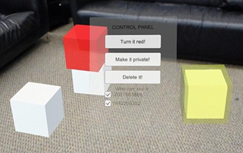
New tools minimize risks in shared,augmented-reality environments(图)
New tool minimize risks augmented-reality environments
2019/10/21
A few summers ago, throngs of people began using the Pokemon Go app, the first mass-market augmented reality (AR) game, to collect virtual creatures hiding in the physical world.For now, AR remains mo...
RECREATING CULTURAL HERITAGE ENVIRONMENTS FOR VR USING PHOTOGRAMMETRY
Virtual Reality Photogrammetry Physically Based Rendering
2019/3/1
In this paper, we propose a workflow for recreating places of cultural heritage in Virtual Reality (VR) using structure from motion (SfM) photogrammetry. The unique texture of heritage places makes th...
EXTENDING INDOOR OPEN STREET MAPPING ENVIRONMENTS TO NAVIGABLE 3D CITYGML BUILDING MODELS: EMERGENCY RESPONSE ASSESSMENT
Emergency evacuation responses Digital data management
2018/11/9
Disaster scenarios in high-rise buildings such as the Address Downtown, Dubai or Grenfell Tower, London have showed ones again the importance of data information availability for emergency management ...
FROM POINT CLOUDS TO 3D ISOVISTS IN INDOOR ENVIRONMENTS
Visibility graphs Path complexity Spatial analysis
2018/11/9
Visibility is a common measure to describe the spatial properties of an environment related to the spatial behaviour. Isovists represent the space that can be seen from one observation point, and they...
COMBINED VISUAL EXPLORATION OF 2D GROUND RADAR AND 3D POINT CLOUD DATA FOR ROAD ENVIRONMENTS
Ground Penetrating Radar 3D Point Cloud Infrastructure Maintenance
2018/11/9
Ground-penetrating 2D radar scans are captured in road environments for examination of pavement condition and below-ground variations such as lowerings and developing pot-holes. 3D point clouds captur...
3D SURVEY IN COMPLEX ARCHAEOLOGICAL ENVIRONMENTS: AN APPROACH BY TERRESTRIAL LASER SCANNING
Terrestrial Laser Scanner 3D documentation 3D Model Archaeological excavation
2018/6/4
The survey of archaeological sites by appropriate geomatics technologies is an important research topic. In particular, the 3D survey by terrestrial laser scanning has become a common practice for 3D ...
TOWARDS GESTURE-BASED MULTI-USER INTERACTIONS IN COLLABORATIVE VIRTUAL ENVIRONMENTS
Collaborative Virtual Reality Hand and Finger tracking Leap Motion Unity3D Forensics
2018/3/6
We present a virtual reality (VR) setup that enables multiple users to participate in collaborative virtual environments and interact via gestures. A collaborative VR session is established through a ...
第16届ASCE国际工程,科学,建筑和运营挑战环境大会(16th Biennial ASCE International Conference on Engineering, Science, Construction and Operations in Challenging Environments)
第16届 ASCE 国际工程 科学 建筑 运营 挑战环境 大会
2018/1/8
Over 160 Abstracts received and accepted – All research papers will be presented during the conference. Plan to attend and connect with these experts and leaders in civil engineering, construction, a...
IUTAM Symposium on Mechanical environments of living cells
IUTAM Seminar Living cells Mechanical environment
2017/12/13
IUTAM Symposium on Mechanical environments of living cells
2018年SPIE恶化环境中的情境意识会议(SPIE Situation Awareness in Degraded Environments 2018)
2018年 SPIE 恶化环境 情境意识 会议
2017/11/27
Papers are sought on all aspects of Situation Awareness in Degraded Environments. Applications include both civilian and military operations of both air and surface vehicles.
第五届IEEE空间与极端环境无线国际年会(5th Annual IEEE International Conference on Wireless for Space and Extreme Environments)
第五届 IEEE 空间与极端环境无线 国际年会
2017/9/22
The 5th Annual IEEE International Conference on Wireless for Space and Extreme Environments (WISEE 2017) will be held on October 10 to 12, 2017 at Concordia University, Montréal, QC, Canada.Spacefligh...
FULLY AUTOMATIC FEATURE-BASED REGISTRATION OF MOBILE MAPPING AND AERIAL NADIR IMAGES FOR ENABLING THE ADJUSTMENT OF MOBILE PLATFORM LOCATIONS IN GNSS-DENIED URBAN ENVIRONMENTS
Mobile Mapping Feature Matching Image Orientation Adjustment
2017/7/12
Mobile Mapping (MM) has gained significant importance in the realm of high-resolution data acquisition techniques. MM is able to record georeferenced street-level data in a continuous (laser scanners)...
ASSESSING TEMPORAL BEHAVIOR IN LIDAR POINT CLOUDS OF URBAN ENVIRONMENTS
LiDAR Mobile Mapping Alignment Strip Adjustment Change Detection
2017/7/13
Self-driving cars and robots that run autonomously over long periods of time need high-precision and up-to-date models of the changing environment. The main challenge for creating long term maps of dy...


