搜索结果: 1-15 共查到“工学 Sea”相关记录182条 . 查询时间(0.125 秒)


Year-round navigation of eastern part of Northern Sea Route planned for 2024(图)
浮动动力装置 北海航线 核动力船
2023/5/19

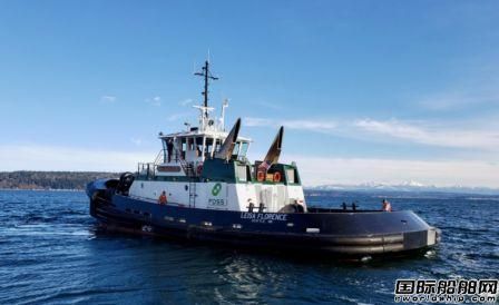
无人自动船软件和系统提供商Sea Machine Robotics公司近日和总部位于美国西雅图的拖船公司Foss Maritime合作,将为Foss公司即将交付的“Rachael Allen”号拖船集成无人自动航行系统。

Generating renewable hydrogen fuel from the sea(图)
Generating renewable hydrogen fuel the sea
2020/10/10
The power of the sun, wind and sea may soon combine to produce clean-burning hydrogen fuel, according to Penn Stateresearchers.The U.S. National Science Foundation-funded team integrated wat...
大型飞机荷载作用下SEA道面结构响应分析
SEA机场道面 A380-800飞机 结构响应 ANSYS Bisar
2019/4/16
利用Bisar及ANASYS建立新型环氧沥青混凝土道面(SEA)结构模型,通过分析A380-800飞机主起落架构造及多项荷载参数,对飞机荷载作用下SEA机场道面面层应力、应变及弯沉等结构响应进行分析,并拟合Bisar三阶差值三维弯沉图。结果表明,A380飞机荷载作用在SEA道面上时,A380飞机主起落架前六轮主要承受载荷,应力应变分布较为均匀,出现双峰值现象;后四轮纵向应力应变较横向大,易出现应力...
SEA ICE THICKNESS MEASUREMENT BY GROUND PENETRATING RADAR FOR GROUND TRUTH OF MICROWAVE REMOTE SENSING DATA
Sea ice thickness measurement, Microwave remote sensing Ground truth Ground Penetrating Radar Brackish lake Finite-Difference Time-Domain method Dielectric constant
2018/5/15
Observation of sea ice thickness is one of key issues to understand regional effect of global warming. One of approaches to monitor sea ice in large area is microwave remote sensing data analysis. How...
THRESHOLD DETERMINATION FOR LOCAL INSTANTANEOUS SEA SURFACE HEIGHT DERIVATION WITH ICEBRIDGE DATA IN BEAUFORT SEA
IceBridge optimal threshold Sea surface reference Beaufort sea
2018/5/17
The NASA Operation IceBridge (OIB) mission is the largest program in the Earth’s polar remote sensing science observation project currently, initiated in 2009, which collects airborne remote sensing m...
OIL SPILL AISA+ HYPERSPECTRAL DATA DETECTION BASED ON DIFFERENT SEA SURFACE GLINT SUPPRESSION METHODS
Oil Spill Detection Hyperspectral Data Glint Suppression Wavelet Transform Enhanced Lee Filter
2018/5/16
The marine oil spill is a sudden event, and the airborne hyperspectral means to detect the oil spill is an important part of the rapid response. Sun glint, the specular reflection of sun light from wa...
THIN ICE AREA EXTRACTION IN THE SEASONAL SEA ICE ZONES OF THE NORTHERN HEMISPHERE USING MODIS DATA
Sea Ice Optical Sensor Global Warming Glaciology
2018/5/14
Sea ice has an important role of reflecting the solar radiation back into space. However, once the sea ice area melts, the area starts to absorb the solar radiation which accelerates the global warmin...
SEA ICE DRIFT MONITORING IN THE BOHAI SEA BASED ON GF4 SATELLITE
GF4 image Sea ice Sift MCC Monitor
2018/5/17
The Bohai Sea is the inland sea with the highest latitude in China. In winter, the phenomenon of freezing occurs in the Bohai Sea due to frequent cold wave influx. According to historical records, the...
HIMAWARI-8 GEOSTATIONARY SATELLITE OBSERVATION OF THE INTERNAL SOLITARY WAVES IN THE SOUTH CHINA SEA
Himawari-8 Advanced Himawari Imager Internal Solitary Waves South China Sea
2018/5/14
The new generation geostationary meteorological satellite, Himawari-8 (H-8), was launched in 2015. Its main payload, the Advanced Himawari Imager (AHI), can observe the earth with 10-minute interval a...
INCORRECT MATCH DETECTION METHOD FOR ARCTIC SEA-ICE RECONSTRUCTION USING UAV IMAGES
Unmanned Aerial Vehicle Digital Surface Model Image Matching Arctic Sea-Ice
2018/6/4
Shapes and surface roughness, which are considered as key indicators in understanding Arctic sea-ice, can be measured from the digital surface model (DSM) of the target area. Unmanned aerial vehicle (...
APPLICATION OF GIS AND REMOTE SENSING TO MONITOR THE IMPACT OF DEVELOPMENT ACTIVITIES ON THE COASTAL ZONE OF JAZAN CITY ON THE RED SEA, SAUDI ARABIA
Urbanization Edge images Urban Land Use Infrastructure Growth Multi-Temporal Landsat
2018/4/18
Jazan city is a fast-growing coastal city in the southern part of Saudi Arabia, Red Sea. Recently, it has encountered quick industrial development activities. To monitor these activities, the changes ...
APPLICATION OF GIS AND REMOTE SENSING TO MONITOR THE IMPACT OF DEVELOPMENT ACTIVITIES ON THE COASTAL ZONE OF JAZAN CITY ON THE RED SEA, SAUDI ARABIA
Urbanization Edge images Urban, L Use Infrastructure Growth Multi-Temporal Landsat
2018/5/8
Jazan city is a fast-growing coastal city in the southern part of Saudi Arabia, Red Sea. Recently, it has encountered quick industrial development activities. To monitor these activities, the changes ...

A Sea of Spinning Electrons(图)
Sea Spinning Electrons
2017/10/25
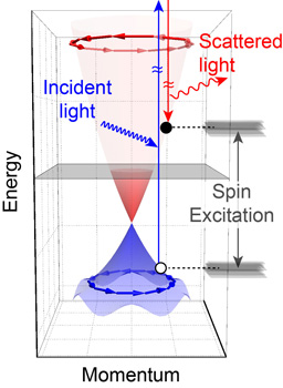
Picture two schools of fish swimming in clockwise and counterclockwise circles. It’s enough to make your head spin, and now scientists at Rutgers University-New Brunswick and the University of Florida...


